


 +86-20-82108930
 info@alpha-surveying.com


Alpha 4AR Visual RTK with Drone Mode: More Than Real-World Stakeout
Time:2026-09-29 10:22:52
Alpha 4AR Visual RTK with Drone Mode: More Than Real-World Stakeout
Alpha 4AR Visual RTK is developed in response to application feedback and evolving needs from thousands of Alpha 4i users around the world. Building on the strengths of the original Alpha 4i Ultra RTK, the 4AR takes the compact design further with the addition of AR real-world stakeout. Compact in size, packed with more capability.
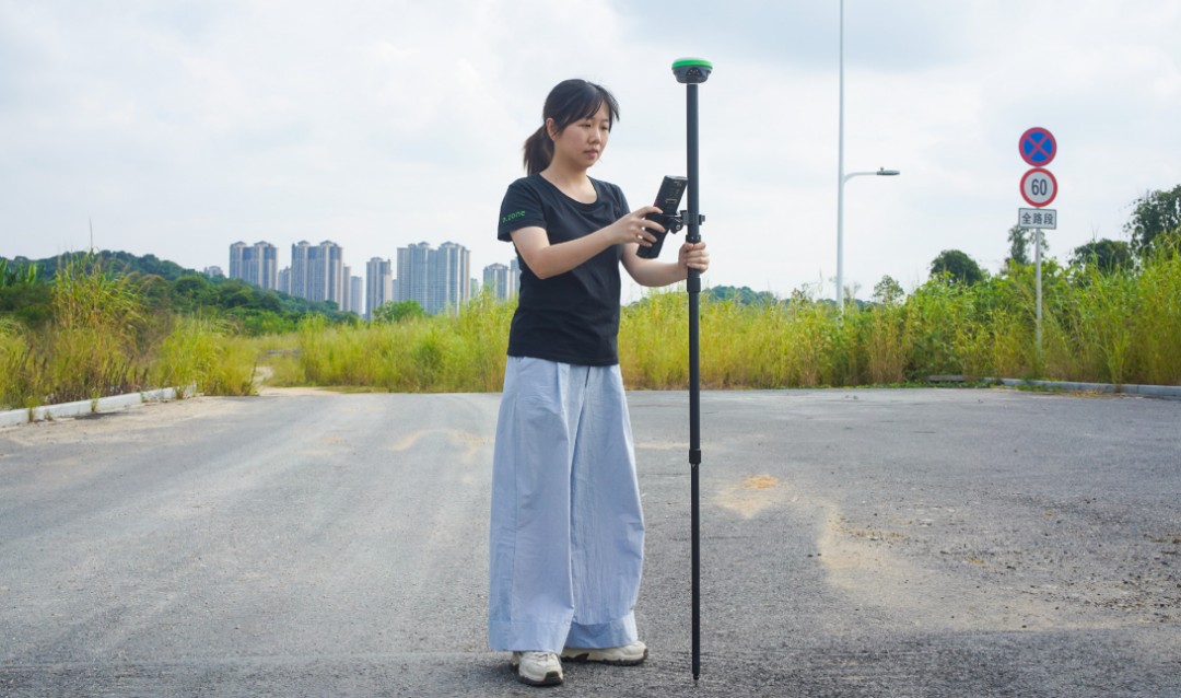
The new AR real-world stakeout feature provides visual guidance to help surveyors quickly locate the target point, eliminating the need for traditional pole-shifting methods. With positioning accuracy of up to 1 cm, it helps make point-finding faster and more efficient.
But there’s another capability, you may not be aware of,— Alpha 4AR can also work as a drone base station.
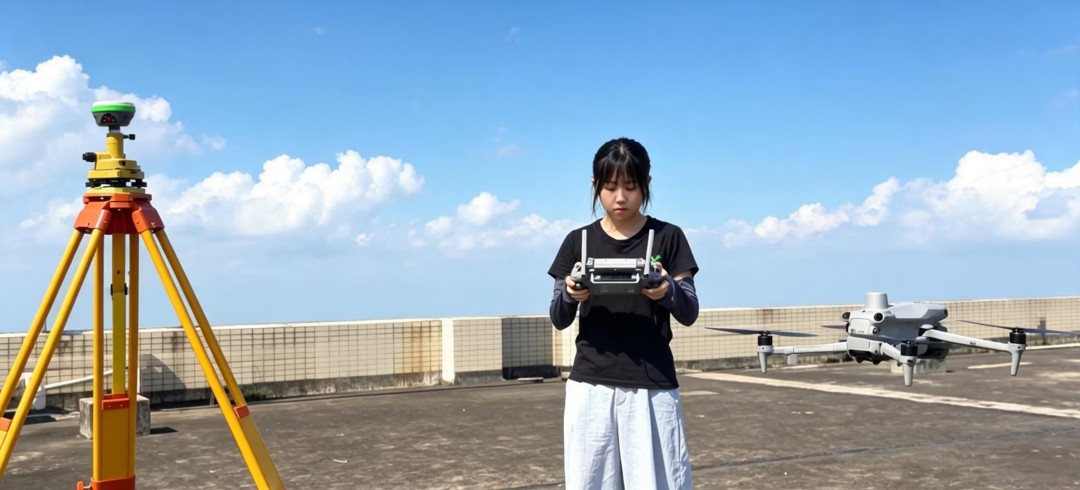
As drone surveying becomes increasingly common, applications such as precision agriculture, power and water infrastructure inspection, renewable energy site inspection, and weather observation are growing rapidly.
For high-precision positioning and accurate flight paths, drones often rely on a ground-based RTK base station to provide real-time correction data.
Alpha 4AR Visual RTK is designed to serve as a reliable RTK base station for drone operations, providing the positioning support needed for high-precision aerial surveying.
01
Stable Signal, Strong Interference Resistance
Drone operations can face unstable GNSS signals when flying near mountains, buildings, power lines, and other sources of interference. For mapping and inspection missions, maintaining a reliable positioning link is essential.
Alpha 4AR combines a next-generation GNSS SoC with a 7-constellation, 24-frequency positioning antenna, supporting multi-constellation positioning across BeiDou, GPS, GLONASS, and more. With 60 dB narrowband interference resistance, it is built to maintain reliable GNSS reception in challenging environments.
Even when satellites are at low elevation angles or the signal is briefly interrupted, the Alpha 4AR can continue delivering stable, high-precision correction data—helping drones maintain centimeter-level positioning throughout the flight.

02
One Base Station for Multiple Drones. ' One Setup '
Set up the Alpha 4AR as an RTK base station, and it can broadcast correction data to multiple drones simultaneously via NTRIP.
One base station, one setup — multiple drones can operate in the same area while receiving high-precision RTK corrections at the same time.
03
Broad Compatibility. Set and to Fly.
Alpha 4AR outputs standard RTCM correction data and supports the NTRIP protocol used by many mainstream drone platforms.
From professional multirotors and fixed-wing UAVs to selected agricultural drones, it connects directly without additional protocol converters or third-party equipment.
Set up once, connect directly, and get to work faster. No extra hardware, no complicated setup.

04
Independent RTK for Remote Areas
Not every drone mission takes place where cellular coverage is available. Mountains, deserts, islands, and remote farmland can all present connectivity challenges, making CORS-based RTK corrections difficult to access.
Alpha 4AR provides a simple alternative: set it up as a local RTK base station and transmit correction data to the drone controller over its built-in Wi-Fi network. The controller then passes the correction data to the drone.
No CORS. No cellular network. Just a local RTK setup that keeps your drone operation moving.
05
WebUI for Easy Base Station Management
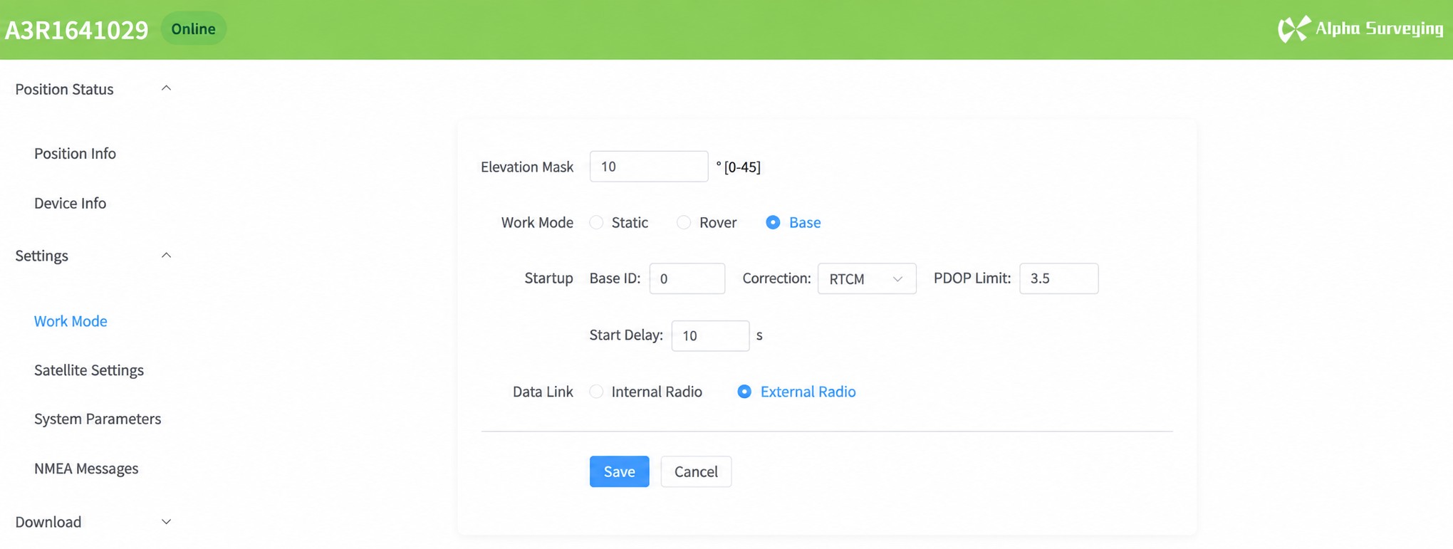
Alpha 4AR features a built-in WebUI, giving field crews a simple way to manage the RTK base station.
Connect with a smartphone or laptop to configure base station settings, check satellite status, and monitor correction data streams directly from a web browser.
No dedicated software or controller required. Spend less time on setup and more time getting the job done.
06
Lightweight. Easy to Deploy.
Alpha 4AR carries on the compact design of the Lightweight RTK series, weighing just 400g.
The lightweight form factor allows one person to quickly carry, set up, and start the base station. For drone operations that require frequent relocation across different areas, the compact design means less time spent moving equipment and setting up, and more time in the air.
07
More Value in One Device
Alpha 4AR Visual RTK is not only a professional ground RTK base station for drones, but also a fully capable RTK rover for ground surveying.
One device, multiple uses — supporting both ground surveying and high-precision positioning for drone operations.

Alpha 4AR Visual RTK is more than a lightweight surveying instrument. It is a portable, reliable, network-independent RTK base station for drone operations, with support for multiple drones sharing the same base station.
As drone surveying becomes increasingly common, Alpha 4AR brings full RTK base station capability in a compact form — helping drones fly with greater positioning accuracy and confidence.
点击右上角
分享给朋友吧






 Long by picture save/share
文章推荐


Copyright @ VillaGrandis All Rights Reserved 粤ICP备2021072613号-2 网站地图
